- 欢迎来到Minecraft插件百科!
- 对百科编辑一脸懵逼?帮助:快速入门带您快速熟悉百科编辑!
- 因近日遭受攻击,百科现已限制编辑,有意编辑请加入插件百科企鹅群:223812289
TerrainControl
| 外文名 | TerrainControl |
| 插件类型 | Spigot / CraftBukkit |
| 最新版本 | v2.7.2 |
| 兼容服务端 | 1.7.2-1.8.3 |
| 前置插件 | 无 |
| 源地址 | http://dev.bukkit.org/bukkit-plugins/TerrainControl |
概述
Terrain Control 是一款高级的地形生成器. 通过多样化的配置文件,它使得用户可以在不了解Java的情况下,而控制Minecraft地形生成机制的大多数方面. 它可以运行在Bukkit/Forge服务端以及带有Forge的单人游戏上. Terrain Control 继承自旧版的 PhoenixTerrainMod, 而其又是基于著名的 BiomeTerrainMod. Terrain Control 由Khoorn维护 (同时也是Github上的 Wickth ).
- 控制水平与垂直方向的地形生成噪声函数
- 控制每个生态群系的地形生成高度以及波动性
- 由图像生成生态群系图
- 控制生态群系,岛屿和大陆的规模
- 自定义生态群系
- 众多关于洞穴与峡谷的设置项
- 控制自然结构的生成,诸如天然矿井、要塞和村庄
- 对矿物、植物、地牢、池塘和其他生成物的完全控制
- 自定义树木和其他对象(BO2 and BO3)
- 替换方块
- 支持视觉设置,如设置树叶的颜色 (需要客户端也安装TerrainControl)
想了解更多,来这里看看吧!
向导
准备工作
安装向导
时间: 2014.1.5 Terrain Control 插件支持CraftBukkit, Spigot, Cauldron and Forge (甚至单人游戏). 一个普通的jar文件可以在所有这些平台上面运行.
- Forge (单人游戏)
首先, 下载并且安装Forge. 运行一次Minecraft以确保所有文件正常运行. 然后通过百科主页面上的下载链接下载插件. 确保和Minecraft本体的版本对应.把文件放进.minecraft文件夹下的mods文件夹.
你现在可以创建一个Terrain Control所定义的世界类型.这个 Mod 只会影响到这一个世界与这个世界的类型. 如果你没有更改在 .minecraft/mods/TerrainControl/worlds/YOUR_WORLD_NAME/ 里面的配置文件, 世界只会成为一个默认的Minecraft世界. 每当你改变了配置, 你必须删除 .minecraft/saves/YOUR_WORLD_NAME/region 文件夹来重新生成世界. 被更改的设置不会影响到已经生成的区块. 向导会教给你如何自定义一个世界类型.
- CraftBukkit, Spigot 和 Cauldron 服务器
只需要把jar文件丢尽plugins文件夹,就像其他的Bukkit插件一样. 这并不需要在玩家的客户端上安装相应的单人游戏版本, 但是如果安装了可以体验到更多的特性.
在你安装完成之后, 你必须仍然为你的新世界激活这个插件. 如果你没有一个多世界管理插件类似于Multiverse, 下面给你的 bukkit.yml 来允许插件操作这个世界 (使用空格按钮, 不要使用 tabs!):
worlds:
  你的世界名称:
    generator: TerrainControl
如果你使用了 Multiverse, 你可以创建一个Terrain Control 类型的时间通过使用命令:
/mv create 世界名称 normal -g TerrainControl
如果你正在使用多世界插件来应用Terrain Control 来更改你的一个默认类型的世界, 也要增加 Terrain Control 到 bukkit.yml (操作:上面描述过). Terrain Control 需要正确的将这个世界初始化为默认世界. (鉴于本人水平,本语段可能出现了歧义) 如果你在使用另一个多世界管理插件, 查找该插件的介绍文档. 使用 TerrainControl (没有一个空格在 Terrain 和 Control之间) 作为控制者名称(即generator 后面填的).区分大小写.
如果你没有更改在 plugins/TerrainControl/worlds/YOUR_WORLD_NAME/ 文件见下的配置, 世界只会成为一个默认的Minecraft世界. 每当你改变了配置, 你必须删除 .minecraft/saves/YOUR_WORLD_NAME/region 文件夹来重新生成世界. 被更改的设置不会影响到已经生成的区块. 向导会教给你如何自定义一个世界类型.
- Forge服务器(也就是官服)
确保Forge安装到了服务器. 把插件放进mods文件夹. 去 server.properties 文件然后设置level-type 到 TerrainControl (没有一个空格在 Terrain 和 Control之间). 删除主世界的 level.dat 来得到一个正确的世界类型.
如果你没有更改在 .minecraft/mods/TerrainControl/worlds/YOUR_WORLD_NAME/ 里面的配置文件, 世界只会成为一个默认的Minecraft世界. 每当你改变了配置, 你必须删除 .minecraft/saves/YOUR_WORLD_NAME/region 文件夹来重新生成世界. 被更改的设置不会影响到已经生成的区块. 向导会教给你如何自定义一个世界类型.
准备工作向导
欢迎,新的使用者!
在你成功的安装Terrain Control之后, 你可以开始创建你的新世界. 创建一个创造模式的世界(TerrainControl作为控制者),世界的种子需要是”12”. 我们使用这个特定的种子是为了使你的世界与教程所介绍的相同.如果你不需要创建一个TerrainControl世界使用这个特定的种子,只需要跳过这个列表.
- 如果你是单人游戏, 左键创建新的世界按钮, 选择创造模式作为游戏模式然后填写一个名字. 左键更多世界选项按钮, 把种子改成12然后选择 TerrainControl 作为世界类型. 确保打开了允许作弊, 你需要使用 /tp 命令.
- 如果你在 Bukkit 服务器上然后你有 Multiverse 多世界插件,你可以使用 /mv create world_name NORMAL -s 12 -g TerrainControl 来创建世界然后使用 /mv tp world_name 来传送到这个世界.
- 如果使用的是另外一个多世界管理插件而且使用的是Bukkit服务器.查询多世界插件的帮助文档.创建一个新世界记得把12作为世界的种子,将TerrainControl作为世界类型.
- 如果你在使用Bukkit服务器但是没有任何多世界管理插件,去 bukkit.yml 然后再增加下列内容:
worlds:
 你的世界名称:
   generator: TerrainControl
记得把 “你的世界名称” 改为你所习惯的世界名称. 而且,在文件里面不要使用tab键,只能使用空格键.前往 server.properties 文件然后将 level-seed 设置为12.删除整个世界文件夹来得到一个全新的 level.dat 文件含有正确的种子.
- 如果你使用的是Forge服务器(官服), 前往 server.properties 然后设置 level-type 为TerrainControl 然后 level-seed 为12. 删除整个世界文件夹来得到一个全新的 level.dat 文件含有正确的种子.
现在登陆一次你的世界让 Terrain Control 生成全新的配置. 使用命令 /seed来验证种子是12. 你会注意到这个世界和默认的Minecraft世界没有任何区别: 别忘记你还没有更改一点点配置文件哟! 关掉你的服务器/游戏吧.
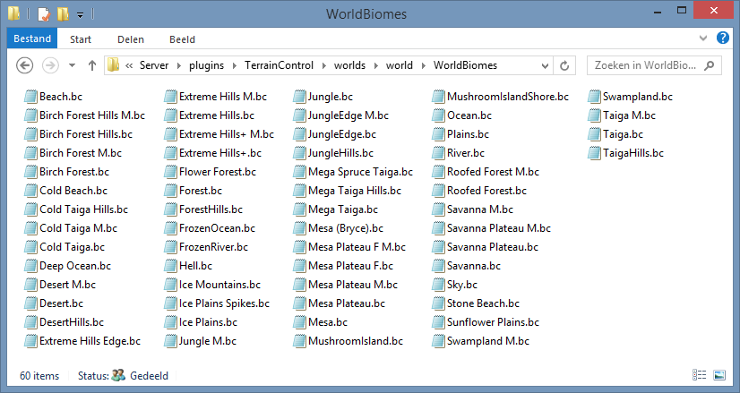
找到你的Terrain Control 设置文件夹.Locate your Terrain Control settings folder. (如果不知道在哪儿可以参考安装说明嘤). 你应该可以看到一些类似于这样的东西:
让我们打开 WorldConfig.ini. 使用Notepad 当然很好哦. 但是不要使用含有字体样式的编辑器哦,比如说Word.
带有 # 开头的行为注释。注释对每一个变量进行了解释。在Wiki的WorldConfig页面上,你还可以找到更多的信息。
为了验证所有的东西都正常工作,我们来更改一个数值试试。GenerationDepth是个好东西来更改。如果你把它设置成9, all biomes get halved in size, in both the x and z directions. If you set it to 11, all biomes get doubled in size, again in both the x and z directions. If you set it to 12 the biomes are as large as in the Large Biomes world type. Let's try that. Change the number to 12 and save the file.
If you would (re)start the game/the server now, you still won't see any changes. You have to explore new areas to see the new terrain, just like for any other generator update in Minecraft. Because this is quite annoying, it is a better idea to delete the region folder inside the world folder. This deletes the terrain, but keeps the player positions and the map seed. Never do this while the game/the server is running!
After you have deleted the region folder, start the game/the server and test your changes. You should now see a world with large biomes.
It's now time to explore the WorldBiomes folder. Again, don't forget to close the game/the server. You see a lot of .bc files, whichs stands for BiomeConfig. Some biomes look very obscure (what is Sky.bc?), others are not a biome at all (Since when is a beach a biome? What about river?), and others use strange names (Mesa Plateau F M?). These names were chosen by Mojang.
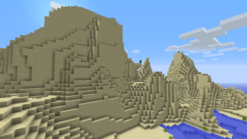
For now you could ignore those strange biomes. Just open up the Desert.bc file. If you scroll down, you will see the BiomeHeight and BiomeVolatility (just below Terrain Generator Variables). Let's add some hills to the desert! Set BiomeHeight to 0.2 (makes the terrain higher, but not more hilly) and BiomeVolatility to 0.4 (makes the terrain more hilly). Now save the result, delete the region folder, and find a desert biome. If you indeed used the seed 12, you can easily teleport to one using the command /tp -19 80 -306.
Maybe the stone in the cliff annoys you, wouldn't sandstone look better? Close the game/the server, open the Desert.bc and set StoneBlock (in the Blocks section) to SANDSTONE. This replaces all stone with sandstone. Stop the game/server, delete the region folder and start the game/server again.
Now you have seen a tiny bit of the power of Terrain Control. It's time for the next step! If you just want to know what each setting does, you can take a look at the other settings in WorldConfig and the BiomeConfigs. If you want to start creating custom biomes, you should read this tutorial, which starts at the point where this tutorial ends. On the home page you could also find a lot of other (external) tutorials. The examples page might also be useful.
Your first custom biome
In this tutorial we are going to create our first custom biome. In the previous tutorial we modified the standard desert to be more hilly and to have sandstone instead of stone. We will now create a hilly area with a lot of flowers and some trees.
You can continue working on the world of the previous tutorial. Alternatively, you can create a new world with the seed 12. Make sure that the GenerationDepth setting (found in the WorldConfig.ini) is set to 12 too. This will make the biomes bigger. If you have done that correctly, the coordinates found in the tutorial will work for you. If not, you will find yourself lost in some other biome and you'll have to search around a lot.
We'll start by adding the custom biome to the biome lists. The first list we are going to modify is the CustomBiomes list. Open up the WorldConfig.ini file and search for that setting. Edit the line with CustomBiomes to look like this:
CustomBiomes:Flowerfield:40
This will make Terrain Control generate and read the config files for the biome called Flowerfield. The biome will have the id 40. Biome ids work just like block ids, except that they are separate lists and that 254 is the highest possible biome id. Just like block ids, two biomes may not share the same id.
If you restart the server/game now, you'll see that a new file in the BiomeConfigs directory has popped up: FlowerfieldBiomeConfig.ini. However, your world looks still the same. We need to add our biome to one of the biome lists. NormalBiomes, found in the WorldConfig.ini, is a good choice, as it lets the biome generate as a normal biome, just like most of Minecraft's biomes. Add your biome to the NormalBiomes list:
NormalBiomes:Desert,Forest,Extreme Hills,Swampland,Plains,Taiga,Jungle,Flowerfield
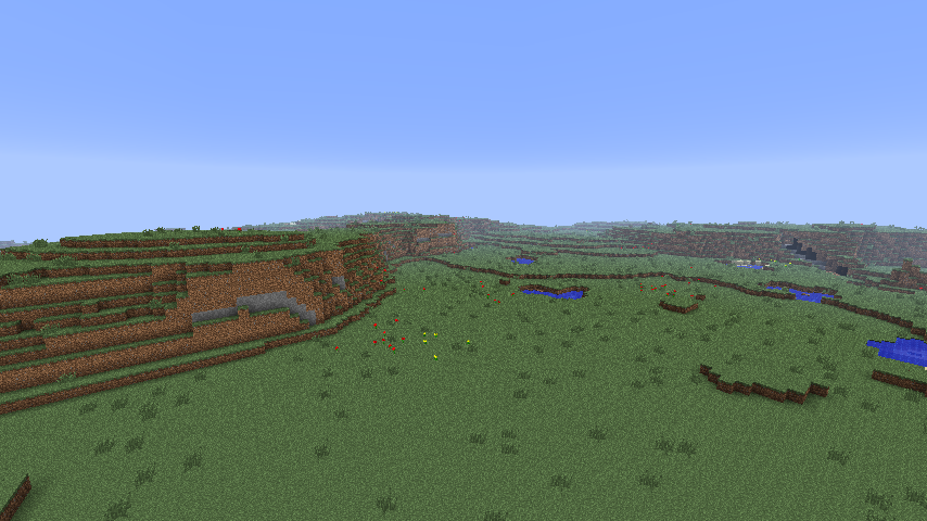
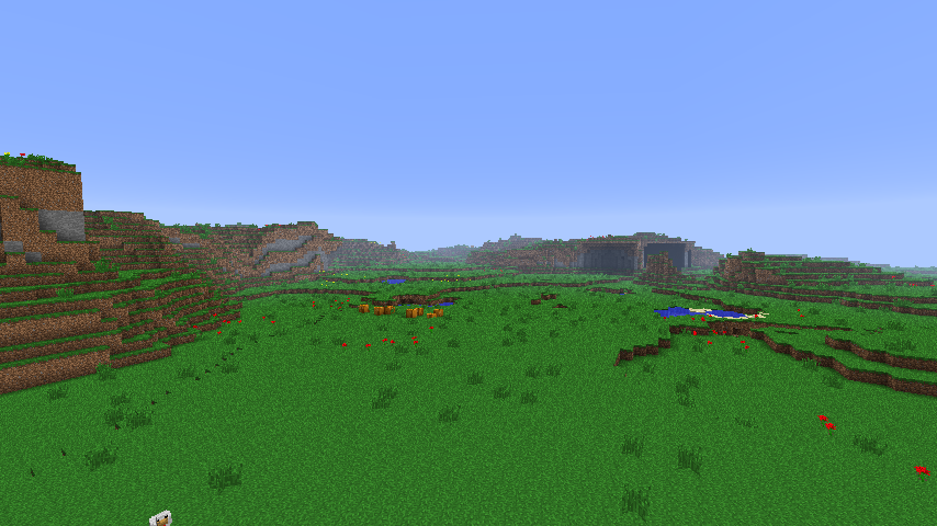
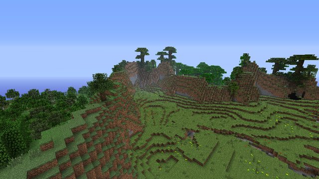
Make sure the server is closed/world is unloaded, remove the region folder inside the world folder and start the server/load the world again. If use the command /tp -1010 78 -11 to teleport to that location, you can see the custom biome. It doesn't look very nice yet, but hey, we haven't yet changed any settings of the biome:
If you aren't using the Terrain Control mod on singleplayer, the colors will look a little bit different.
First of all, we are going to make the biome a lot greener. Open up the FlowerfieldBiomeConfig.ini. Scroll down until you see the Visuals and weather section. You can change the colors of the biome here. However, if you don't have the Terrain Control client mod, you won't see any effect. If you are going to use the map on singleplayer, this is of course no problem, but if you are going to use the world on a Bukkit server, most of your players will only see the standard Minecraft colors. All colors are hexadecimal. You can Google around a bit to find a color picker. Please note that most color pickers will prefix the color with a #, which is common in the webdesign-world. Terrain Control however requires you to use 0x instead, which is common in the Java-world.
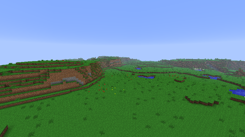
For this tutorial, we aren't going to use the color settings. Terrain Control has a cool option to save the biome with the id of another biome. This will cause the colors, weather and mobs of the biome to look like the other biome. Luckily, the terrain shape and features will still look the same. We are going to use the mushroom isle biome for this, as it has nice green grass (normally you can't see that, as the biome is covered in mycelium, but try placing down a block of grass there and you'll see it). As an added bonus, no hostily mobs will spawn in our flower field, as the mushroom biome has them disabled. Scroll up to find the ReplaceToBiomeName setting and set it to MushroomIsland.
Make sure the server is closed/world is unloaded, remove the region folder inside the world folder and start the server/load the world again. If use the command /tp -1010 78 -11 to teleport to that location, you can now see that the biome is a lot greener:
Now we are going to make the biome a bit more hilly. Open up the FlowerfieldBiomeConfig.ini again and set BiomeVolatility to 0.5. If you would take a look now, you'll see that the land drops below sea level now on some places. We don't want this, so to fix this we raise the biome a bit, without making it more hilly. Set BiomeHeight to 0.5 to make the biome a bit higher.
Close the server/world, remove the region folder and open the server/world again. You should now see some hills:
Now we are going to add some resources to the biome. Terrain Control has a powerful resource system. It consists of a long list of resources. Each resource can be an ore, a plant, a tree, a small lake, etc. Almost all resources have a frequency setting which tells how many times that resource must be processed for the chunk. Almost all resources also have a rarity setting, which determines the chance of success for each attempt. Usually the terrain is another limiting factor: if there is not enough space for a tree there, it simply won't spawn, regardless of a rarity of 100.
Resources use the function syntax, which is also used on some other places in the configs. It works like this:
NameOfFunction(parameter,parameter,parameter,...)
If you already have experience with a spreadsheet program like Microsoft Excel, this syntax should be familiar. Each parameter does affects something in the resource.
All resources placed together form a list, called the resources queue. It is out of the scope of this tutorial to explain every possible resource (see this page for that), but some interesting resources for our plant biome will be described.
Flowers are single block resources in Minecraft. In the resources queue there are two resources designed for single-block things. Grass is easier to work with than Plant, but it can only spawn on top of the terrain. Plant chooses a random height between it' min and max height and then looks whether the location is suitable. Grass simply places itself on the highest block, which it can look up from the heightmap.
For some reason Mojang placed flowers using the Plant resource in Minecraft. There is no reason for us to do the same, we are going to use the Grass resource. The syntax of the Grass resource is as follows:
Grass(Block,BlockData,Frequency,Rarity,BlockSource[,BlockSource2,BlockSource3.....])
Block is the id or name of the block to spawn. BlockData is the block data from 0 to 15. Frequency and Rarity were just explained a few paragraphs back. BlockSource is the block to spawn on.
First of all, we remove the standard lines with flowers, as we are not going to use the Plant resource for them. Remove these two lines from the resources queue:
Plant(RED_ROSE,2,100.0,0,128,GRASS,DIRT,SOIL) Plant(YELLOW_FLOWER,2,100.0,0,128,GRASS,DIRT,SOIL) And add the following Grass resources at the end of the resources queue:
Grass(RED_ROSE,0,40,100,GRASS) Grass(YELLOW_FLOWER,0,80,100,GRASS) This should add 40 red roses and 80 yellow flowers to each chunk. Of course, the terrain is not always suitable, so we'll see less flowers. Another thing is that on each attempt a random location in the chunk is choses, which means that it can choose a location that already has a flower!
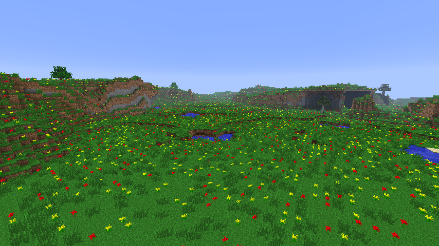
Nevertheless, if you close the server/world, remove the region folder and open the server/world again, you should see this:
That are a lot of flowers! Let's add some tall grass as well to the biome. There is already a tall grass resource in the resources queue, so let's just increase the frequency of that resource. Change this line:
Grass(LONG_GRASS,1,10,100.0,GRASS,DIRT) To this line: (note that the 10 is replaced with the 80)
Grass(LONG_GRASS,1,80,100.0,GRASS,DIRT) Close the server/world, remove the region folder and open the server/world again. Looks a lot better, doesn't it:
We're almost done with this tutorial, but we still want to add some trees. Without trees, it is very difficult to survive in a biome. The syntax of the tree resource is as follows:
Tree(Frequency,TreeType,TreeType_Chance[,Additional_TreeType,Additional_TreeType_Chance.....])
It has a nifty syntax to specify what trees you want. For each attempt (there are Frequency attempts), it first chooses the first TreeType. If this Treetype fails to spawn, either because of the TreeType_Chance (this is a success percentage) or because of unsuitable terrain, it continues to the next one, the Additional_TreeType. If that tree also fails to spawn, it continues to the next one. This continues until all tree types in the list have been processed.
Some tree types have bad names. For example, Forest is actually a birch tree. Tree is simply an oak tree.
Add this line to the end of the resources queue:
Tree(1,Forest,4,Tree,4) This means that there is just one attempt in each chunk. In that attempt, there is a 4% chance that the birch spawns (provided the terrain is suitable for that tree). If the birch tree doesn't spawn, there is a 4% chance that a normal oak tree will spawn.
Close the server/world, remove the region folder and open the server/world again. Our biome is now technically finished:
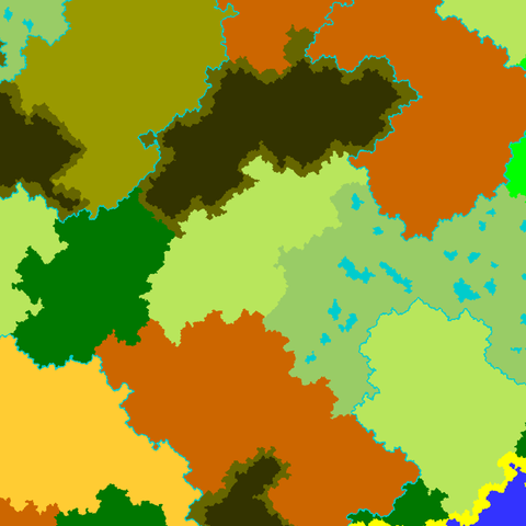
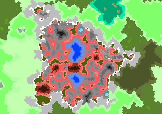
However, if you are on Bukkit and use the command /tc map, the biome will show up as a block biome. You can change this by choosing another color for the BiomeColor setting. We will use 0xb8e65c. Close the server/world, remove the region folder and open the server/world again. Execute the command /tc map. You should get a map like this one:
If you had any problems recreating this world, you can download the completed version here.
Congratulations, you have just created your own custom biome! You can now create as many custom biomes as you want. You know how to create hills, forests, grass, flowers, etc. Some additional tips:
- BiomeTemperature:0 will cause the biome to be covered by snow. However, people without the TC mod on the client will see snow on the ground, but rain in the air. To fix this you can use ReplaceToBiomeName:Taiga.
- Water is generated when the terrain falls under the sea level. Using the BiomeVolatility and BiomeHeight settings you can best control how the land is shaped.
- Take a look in the configs of the default biomes to see how a certain effect is achieved. The downloads thread in the TC forums is also a valuable resource.
Good luck!
Common problems
Terrain Control doesn't always do what you would expect. On this page some problems frequently encountered by beginners are highlighted. If you're still stuck, you can create a forum topic that describes your problem. Be as detailed as possible and be prepared to post your startup log (preferably on pastebin.com or similar) or your settings (preferably in a ZIP file).
- My world settings folder isn't created, only GlobalObjects exists.
Terrain Control won't take over all your worlds when you install it. You'll need to enable it first for a world. Closely follow the installation instructions. When you're still stuck, it is important to post your startup logs when you are creating a forum topic.
- My settings don't have any effect on the terrain.
Have you tried regenerating the terrain? If yes, move your TerrainControl folder, start the server/the game again and look whether Terrain Control has remade the settings files. If not, Terrain Control is not even reading them. See the problem above this one on how to solve that. If yes, look at the BiomeMode and TerrainMode and make sure that they aren't set to Default (which makes them ignore your settings and use the vanilla settings instead).
- I'm spawning in an ocean and I can't find any land
Don't worry, it is there. Keep swimming. Alternatively, you can change the seed of the map (for servers: you'll need a new level.dat for this, changing it only in the server.properies isn't enough) to something else. The seed 11 will spawn you on land with the default settings. You can also disable or reduce the oceans using the LandRarity setting in the WorldConfig:
- This specific setting doesn't work (but other settings do)
Most settings are case sensitive and whitespace sensitive, so be precise. Some settings need higher values to give a noticeable effect. Other settings need the Terrain Control client (see the comments in the files and/or this wiki). Some settings are dependant on another setting (again, see the comments in the files and/or this wiki).
If you are not experienced with Terrain Control, always make sure that SettingsMode is set to WriteAll. This will make Terrain Ontrol reset or remove everything it doesn't understand, so that you'll immediately notice that something was wrong.
Intermediate
如何从一张图片创建世界
如果你不能找到你所需要的信息,你可以参考论坛或使用这个 tutorial by mysource
创造属于你自己的世界是很困难的,河流,岛屿,也许总是会在错误的地方产生,这应该不是你想要的。也许你的山看起来不够好,当然,你也可以拥有更多生物群系的选项。.但是,运用地形控制的功能,从一个图像生成生物群系. 你可以完全操控你的世界,或者使用原有生态环境并改变地形来创建一个图片 to do some small map improvements.
优点与缺点
优点:
- 完全控制你的生物群落
- 使其更容易处理
- 可以用来定制冒险的地图
缺点:
- Images are not infinite, you must fall back on another biome generator when you are outside the image.
- 没有随机生物群系组合:生物群系布局看起来一样好(或坏),正如你所画的。
- 有一些怪异的东西将在下面说明。
创建一个图像
在每一个BiomeConfigs 有一个BiomeColor变量. 这个变量应该是生物群系的十六进制颜色。它不仅用作 /tc map 命令输出颜色,而且作为输入图像的颜色。必须使用准确的“BiomeColor”在画的形象让生物群落产生。Two biomes may not have the same color, if they do that color will result in ocean generating instead. For each custom biome you should change the BiomeColor from 0x000000 (black) to another color.
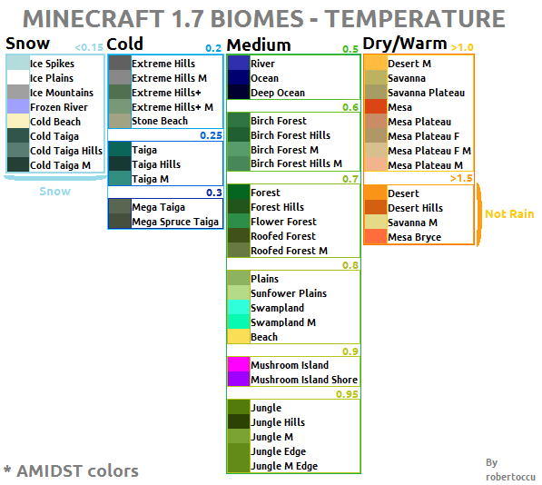
The default biome colors in both RGB and hex (Terrain Control uses the same colors as AMIDST):
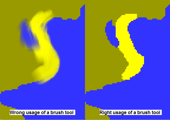
Each pixel on the image represents 4x4 blocks. As said above, the color in the image must be exactly the BiomeColor . Most brush tools of the photo editors won't work, as they change the color to another one:
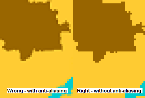
The blurring (called anti-aliasing) allows objects to blend properly with the rest of an image, however Terrain Control doesn't recognize those colors. When Terrain Control finds a color it doesn't have a config for it places ocean. It is better to use editors (commonly called) pencil tool since that tool doesn't use anti-aliasing. Be sure to save the image as a png file as this is the only format supported and most other formats will change the colors during compression. Before generating a world check the image to ensure it hasn't been anti-aliased or compressed.
Another common error is to resize the image without disabling anti-aliasing:
When painting your image from scratch either assume the right edge (right as 'not left', not as 'not wrong') is north, or use the top as north (as most commonly do) and rotate your image 90 degrees clockwise before generating. If you are editing a map made from the /tc map command see that section below.
Letting Terrain Control generate it properly
After you are satified with your image and everything is rotated and resized correctly, it's time to let Terrain Control do the work! Place the image next to the WorldConfig.ini file and take a look at the following settings in that file:
ImageMode - Can be set to ContinueNormal or FillEmpty . ContinueNormal will tell Terrain Control to generate terrain randomly (like BiomeMode:Normal , based on it's settings) once it has hit areas outside the image. FillEmpty will fill any areas outside the image with the biome set in the ImageFillBiome setting, default ocean.
ImageFile - The name of the image file to use, default of map.png. Must be a .png image.
ImageFillBiome - The biome to use for generation once outside of the image area when ImageMode is set to FillEmpty. (Note: need to test if this changes the biome used when TC finds a biome color it doesn't recognize or conflicts with another biome color.)
ImageXOffset and ImageYOffset - Shift the the co-ordinate position of the image, useful for getting the center of your image at x:0 y:0. When using ContinueNormal set these to half the image size. In FillEmpty mode set this to half the image size in the negative value. Example - A 500x500 pixel map.png would have X and Y offset set to 250 in ContinueNormal and -250 in FillEmpty.
Editing a random map using /tc map and ContinueNormal
Terrain Control has the command /tc map to output a biome map. The images generated by it can, with some extra work, be reused as an input image for FromImage .
When using /tc map Terrain Control will make the right edge (right as 'not left', not as 'not wrong') of the map north, so to get north at the top of the image rotate it 90 degrees counter clockwise. When /tc map outputs it does so at 1 pixel = 1 block, but the input is always 1 pixel = 4x4 blocks. To get the image the right size it must be downsized to a quarter its normal size.
Basic world customization
Under construction. The IsleBiomes and BorderBiomes still need to be described. This tutorial will help you shaping your world. In this tutorial only BiomeMode:Normal is described The tutorial is written for both singleplayer and multiplayer, with or without the User Interface. You should already have installed Terrain Control and you should also know how to change the settings and how to regenerate the world. If not, look here for the installation instructions and here for a beginners' tutorial.
Start again with a new world. First of all, open the WorldConfig.ini file and look at the settings below 'Biome Generator Variables' (for the UI: World tab -> Biomes tab). Scroll a little bit down and you will see four variables:
NormalBiomes , IceBiomes , IsleBiomes and BorderBiomes .
To understand them you need a little more background information. The Minecraft world is made of continents. On the mainland the NormalBiomes generate. The rest is filled by the biome Ocean. To make things a bit more interesting you can give biomes a border (for example, beaches are a border between the biome Ocean and most other biomes) using the BorderBiomes . Also you can generate biomes inside other biomes. They are called IsleBiomes . For example, MushroomIsland is a isle biome inside the Ocean biome. Some areas of the map are marked as 'frozen'. When a frozen area is generated on top of a continent one of the IceBiomes will spawn (instead of one of the 'NormalBiomes'). If it's generated on top of an ocean the biome FrozenOcean will spawn (however you can toggle this off).
Technical biomes
There are also some 'technical biomes'. They are not considered as a true biome, but they make the terrain more varied. This section describes their function in the default settings, and maybe inspires you to create your own. Keep in mind that you can change everything: if you would want, you could even generate the TaigaHills biome as a border between jungles and deserts.
River is one of the technical biomes: it's called a river, but it is just a biome with a lot of water. The world generator places that biome on top of the continents (in the shape of a river), and when a frozen area generates on top of a river, the biome FrozenRiver generates instead (however you can toggle this off). You can edit the RiverBiomeConfig to generate something that doesn't look like a river at all:
There are also some Hill-biomes: TaigaHills, JungleHills, DesertHills and ForestHills. Those are added as a IsleBiome and they generate inside the Taiga, Jungle, Desert and Forest. When you see a large hill inside one of these biomes, you can be sure that you are looking to a HillsBiome. (Although Extreme Hills is added to the 'NormalBiomes' and doesn't generate inside other biomes). River, which is just a biome with much water, is also added as a IsleBiome : it is generated as an isle inside the swamps.
MushroomIslandShore is generated as a BorderBiome between the MushroomIsland and all other biomes (usually an ocean) to smooth out the transition, and Extreme Hills Edge (also a BorderBiome ) is added to smooth out the transitions between the Extreme Hills and most other biomes.
Most people working with Terrain Control use a lot of technical biomes to generate the terrain they want. They use them to smooth out the transition between two biomes, to make a biome more varied, to generate snow peaks, etcetera. For example, Burckhart has used a lot of BorderBiomes and IsleBiomes to generate a mountain range.
NormalBiomes
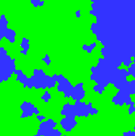
Here you can see a map of just land and ocean.
The green areas are filled with the NormalBiomes and the blue areas are filled with the biome Ocean.
You can use the variable LandRarity to adjust the ratio between land and ocean:
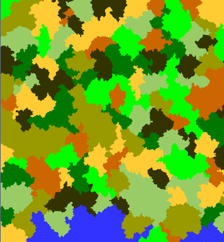
Now it's time to see how that green land is filled. We set LandRarity on 100. If you look at the NormalBiomes variable, you will see the following:
NormalBiomes:Desert,Forest,Extreme Hills,Swampland,Plains,Taiga,Jungle
Which gives the following biome map ( IsleBiomes and IceBiomes are removed so that the image looks cleaner):
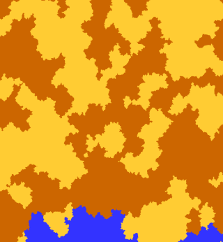
If you want a hot world, you can remove most biomes from NormalBiomes :
NormalBiomes:Desert,Jungle
(If you still see some cold areas ingame, it's because of the IceBiomes . We see about them later.)
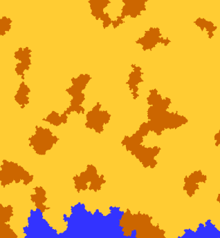
You can change the rarity of the biomes in the BiomeConfigs. If you want to have less jungles in your world, go to the JungleBiomeConfig.ini and set BiomeRarity (which is actually the biome probability) to 25.
That was it for NormalBiomes for now. Later on we will add our own custom biomes.
IsleBiomes
TODO: Here we play around with some isle biomes
Isle biomes are biomes that can be placed in other biomes. The biome needs to be smaller (so BiomeSize needs to be higher) to be able to spawn in another biome.
When a biome is used as an isle biome BiomeRarity works slightly different. It is now very sensitive: BiomeRarity:100 will make it spawn everywhere in the biome (except at the borders - to fill that area you should use a border biome). BiomeRarity:99 will make it spawn in about 50% of the biome, BiomeRarity:98 in 25% of the biome and so on.
Mister_Tesseract has made a detailed tutorial about isle biomes. Read it here.
BorderBiomes
TODO 译者注:这是作者还没有完成,不是译者没有翻译
IceBiomes
Some parts of the world are marked as 'frozen'. If a frozen area is generated on top of a continent, one of the IceBiomes will spawn. If a frozen area is generated on top of a river, the biome FrozenRiver will spawn instead. You can toggle this off by setting FrozenRivers (WorldConfig) to false. If a frozen area is generated on top of an ocean, the biome FrozenOcean will spawn. You can toggle this off by setting FrozenOcean (WorldConfig) to false.
You can change the probability of the frozen areas by changing the IceRarity variable. Lower values give less frozen areas, higher values will make more parts of the map frozen.
Please note that the temperature of the biome is not determined by adding it to the IceBiomes list, but by the BiomeTemperature variable in the BiomeConfigs. You can have cold biomes in the NormalBiomes list (Taiga is an example of that in the default configs), and you can have hot biomes in the IceBiomes list. This makes the name IceBiomes a little misleading.
CustomBiomes
By default only the vanilla biomes are in the BiomeConfigs folder. To add your own biome you must first add it to the CustomBiomes list. This will make Terrain Control generate it's settings file (or use the file if it already exists). However, it doesn't generate them in the world. Just like the vanilla biomes you must add it to one or more of the four biome lists. So your custom biome is always on at least two places in the WorldConfig.ini.
(However, you can also let your biomes generate from an image, in which you just add it to the CustomBiomes list and to the image. More about that over here.)
After each entry in the list you will see a ":" with a number after it (if you don't add it by yourself, Terrain Control will add it):
CustomBiomes:MyBiome:50,MyOtherBiome:51
This is the biome id which is saved in the world. Never change this without resetting the world! (Imagine you had a custom Jungle biome with id 50, and now the id 50 is used by a snow biome. This would cause all custom Jungles to be frozen!) Also, never use a id that is already in use by vanilla. Currently vanilla uses the ids 0-22, but as new biomes are added to vanilla, new biome ids will be used. If you use a biome id above 40 you should be save for a very long time.
Basic biomes customization
This page focuses on the basics of creating and editing biomes including changing ground and water blocks, ore generation, tree/plant spawning and creating hills/pits. For info on the ReplacedBlocks feature, using CustomHeightControl and more difficult features like waterfalls see Advance Biomes Customization (Under Construction).
Biome editing may be broken into four main parts: biome placement, terrain shape, biome population and appearance. For information on biome placement see this tutorial.
Terrain shape
The basic shape of the terrain is affected by a lt of variables. You can change the height, how hilly it is and up to what level air blocks should be filled with water blocks. The shape of the terrain is forming during the first pass of terrain generation, just after the biomes have been calculated.
Terrain height
The first and most important variable in determining a biomes height is the BiomeHeight setting. This variable is dependent on what WorldHeightBits is set to in the worldconfig. Minecraft divides the terrain height it generates into equal positive and negative values with a BiomeHeight of 0.0 representing the middle. On default settings ( WorldHeightBits:7 ) the terrain will generate up to 128 blocks in height, which would put BiomeHeight:0.0 at y=64. If WorldHeightBits is changed to 8 then the generation height doubles to 256, and every height settings effect roughly doubles. BiomeHeight:0.0 becomes y=128 and upping it to 0.1 will have double the effect of raising it to 0.1 on WorldHeightBits:7 . Upping the WorldHeightBits to 8 is necessary to get terrain generation up to the maximum of 256. WorldHeightBits may be lowered to have the opposite effect, with each step lower the terrain generation max height will be cut in half. A WorldHeightBits of 6 would not generate terrain above y=64. Note: these two features do not work if the generator is set to OldGenerator in the WorldConfig.
Changing ExtraBiomeHeight can create overhangs and cliffs 8 times its value. Changing ExtraHeightConstrictWaist determines how the cliffs generate. Keeping values between -0.4 and 1.0, positive values give the cliffs an hour glass like shape by removing the middle region ( 4 x ExtraBiomeHeight ). Greater than 1.0 can cause hanging and floating terrain. Negative values cause the middle region ( 4 x ExtraBiomeHeight ) to expand. Decreasing below -0.4 can start to create shelves that can have massive caves beneath.
The following table can help with determining what height settings to use based on WorldHeightBits of 7 and 8. Do not use -2.0 as a BiomeHeight setting as this is bugged (causes a division by zero). Also note the terrain will not generate to the max of 256 and will stop at 255, if not a few blocks before that. BiomeHeight may have any value between -10 and 10, although any value above/below 4/-4 has no further effect.
| BiomeHeight | WorldHeightBits:7 | WorldHeightBits:8 |
|---|---|---|
| -4 | 0 | 0 |
| -3.5 | 7 | 10 |
| -3 | 16 | 28 |
| -2.5 | 24 | 45 |
| -2 | Error | Error |
| -1.99 | 32 | 60 |
| -1.5 | 40 | 78 |
| -1 | 48 | 95 |
| -0.5 | 57 | 111 |
| 0 | 67 | 128 |
| 0.5 | 76 | 144 |
| 1 | 85 | 156 |
| 1.5 | 94 | 173 |
| 2 | 102 | 190 |
| 2.5 | 111 | 207 |
| 3 | 119 | 223 |
| 3.5 | 128 | 240 |
| 4 | 128 | 255 |
Terrain volatility
There are a lot of settings to fine-tune how hilly the terrain is. The most important of them is BiomeVolatility . Increasing it will make the terrain more hilly. 0.0 makes the terrain almost flat. A value of 1.0 will give you hills. 2.0 gives you cliffs. Just like BiomeHeight the effects are doubled on WorldHeightBits:8 . This setting does not work on TerrainMode:OldGenerator .
Biome population
During the second pass of terrain generation the biomes are populated with resources like ores, trees, custom objects, flowers, tall grasses and small ponds above/below sea level. After this is done, biomes with a low BiomeTemperature will be covered in snow.
You can find all resources in the Resources queue.
Appearance
There are things that haven't got anything to do with terrain generation, but that you still want to change. For exampe, uou can edit the colors and weather of the biome. Sadly, the vanilla singleplayer client will ignore all those settings. It will also display custom (non-vanilla) biomes with the colors and weather of the plains biome. Players will need to install the Forge version of Terrain Control to fix this.
These settings, along with a description, can be found here.
Advanced
A TerrainControl Analysis
Slice It Up
A TerrainControl Analysis by Mister_Tesseract, modified by the community.
This page has been copied from here over to the wiki. Discuss this article in this forum thread.
Table of contents
- Introduction
- The chosen “default” values for the variables
- Generation Process
- IceSize and Ice Biomes
- Border and Isle Biomes
- BiomeRarity
- BiomeColor
- RiverBiome
- BiomeTemperature and BiomeWetness
- ReplaceToBiomeName
- BiomeHeight
- FractureHorizontal and FractureVertical
- BiomeVolatility
- MaxAverageHeight and MaxAverageDepth
- Volatility1 and Volatility2
- CustomHeightControl
- SurfaceBlock and GroundBlock
- UseWorldWaterLevel
- ReplacedBlocks
- Biome visual settings
- Credits
Introduction
Hello and thank you for your interest in this research about TerrainControl. I, Mister_Tesseract, call it a “research” and not a “tutorial” because it is more than a tutorial in that it tries to understand how the plugin works beyond what you really need to make it work in a general purpose. It is also less than a tutorial because it doesn’t provide many how-to’s (but perhaps I will do that a little more in the future). My ambition with this research is that after reading this once it is complete, you should be able to understand the deep mechanics that rule the TerrainControl generator enough to make virtually every possible biome in Minecraft.
Why not a simple step-by-step tutorial? I see two main reasons for this.
The first one is that TerrainControl is such a complex and vaste plugin that you cannot learn much from a step-by-step tutorial that would teach you how to make just one biome and then leave you on your own. There are so many parameters in TerrainControl that a tutorial would need to guide you through the creation of at least ten different biomes in order to have you get a glimpse of what it can do.
The second reason, a more personal one, is that it’s not my style to make that kind of tutorial. I have studied physics (and epistemology a little) and all that science gives you a methodology you cannot get out of your head just like that (and it’s so cool). So I set up an experimental protocol, I take measurements, I estimate margins of error, and I try to find applications for the newly acquired knowledge, which is pretty much what researchers do. This method cannot lead to a how-to tutorial without loss of information. But in the future I’m probably going to try and make a “generic” how-to which will explain in what order it is best to build a biome.
Obviously, I could look inside the source code and find the exact laws that rule the TerrainControl plugin and the Minecraft generator (or maybe I’ll find nothing at all) but believe me or not, I do this as if it was part of the game ; and I actually find it interesting and funny. In other words, I’m like a Minecraft crazy scientist trying to find the laws of the creation the universe.
Sometimes I might not be very clear in my explanations, and I apologize in advance for anything you couldn’t understand and that is due to my lack of clarity. Such clarity is one of my objectives but my priority was to finish a first version in order to release it as soon as possible. Hopefully that clarity will soon stop being a problem thanks to your feedback.
I try to use generated map images (with the command /tc map) as much as possible but sometimes I had to make more precise measurements, or it just didn’t help to have a map image (for instance when the image doesn’t show altitude). Here is the method I followed when a map image was not enough to fulfill the requirements in precision: 1.Create a world config with only one Biome in addition to Ocean and use it in a new world. 2.Delete the region folder if there is one. 3.Start the game in that world and make measurements about height, slope and shape of the terrain, and vegetation and ores. 4.Change a setting in the Biome config and save. 5.Quit the game. 6.Repeat from 2. until having enough measurements to have an accurate enough idea of the curve’s behaviour.
What I am looking for in this research is pertinence in terms of utility and not necessarily finding the exact inflection point of a function. For example, sometimes I will indicate what happens if you set a value inferior to -0.25 for MaxAverageHeight , but if you go at -0.20 it won't change very much so I could have put -0.20 to be more precise in my work. But the value -0.25 is safe and precise enough to be used as a zero and the lost information is a low cost compared to the time it would take to find the limit with better precision. This is what I mean by ‘utility’.
This partially explains the absence of regular intervals in the tables. You will also find odd values like 3.62 followed by 4.0 which seem close enough but I kept the measurement made at 3.62 because it gives a better idea of how strong you have to go down from 256.
There is also the default irregularity in terrain when all values are zero or close to their minimal effect. This doesn’t allow a perfect output in layer numbers because the terrain is not perfectly flat, even in the flattest areas (with most settings). I decided to choose the layer of floor that seemed to be the most represented in my environment after looking around a little, which was closest to the idea of an average/median value.
This study is evaluating every separate variable all other things being equal. If you have different results it is probably because you changed two variables at once. Some combinations of several variable changes will give expected results and some won’t. It is already a huge work to study each variable separately ; I probably won’t step into the details of studying every couple or triplet because it would take a very long time.
A very important point about all this research is that I write things here as I discover them. The facts (measurements) are obviously real and you will be able to reproduce them at will; but my interpretation is relative and it is always possible that a new fact comes burn my paradigm down to ashes. It happened to me when I came to Border and Isle biomes, as their size couldn’t match my interpretation. I then had to start from square one with world generation.
Conclusion: take every interpretation I make about this with a grain of salt. This is science, and as Karl Popper established it, if it’s science, then it can be tested. Even the most certain knowledge can be rammed down by the tiniest new fact. That is why I encourage you to comment and tell me when I’m wrong so the interpretation can be rebuilt and our knowledge in TerrainControl can see progress.
The chosen “default” values for the variables
The values and effects provided here were determined with using this WorldConfig.ini with a flat, resourceless PlainsBiomeConfig.ini biome. There are a few differences with default/vanilla settings:
- WorldHeightBits = 8 (max land height = 28 = 256) so regular land will be at layer 128 (instead of 64 for vanilla Minecraft). The default value for this is usually 7, which prevents land from appearing above layer 128.
- Almost every biome value is 0.0. The values that differ from zero are VolatilityWeight1 and VolatilityWeight2 because their default values are repectively 0.5 and 0.45. Sometimes BiomeVolatility is 0.1 instead of 0.0 because it looks like other variables are multiplied by BiomeVolatility and 0.0 would nullify them.
- No resources at all, for faster generation: it’s a lot of work for the computer to generate a new map at every game, and finding ores is of course not the objective. This is true for doing research like mine, but it is also true when it comes to creating custom biomes. There will be a point where you’ll be reloading a new map every 60 seconds and change the value by 0.05 in order to get the fine tune. Then you want to go as fast as possible and resource generation takes a lot of processing time. That is why ore, trees and mob distribution is the thing you want to create in last position in your biome, especially with a slow computer. Of course, when it will come to researching about ore generation, it will be included as well.
Generation Process
This part is about how I view how terrain generation works. I have acquired a good comprehension of it after reading this thread on the forums of dev.bukkit.org and I have developed my own way to formulating it but it’s basically the same explanation.
I wanted to explain separately WorldConfig.ini and xBiomeConfig.ini but it’s not possible to do without gaps or redundancy so I’m going to explain both of them as a whole. You will just have to figure out yourself where each variable stands.
One thing that I want to point at is that you can use any seed for TerrainControl. I noticed on the bukkit forums that some people kept using the seed “tim1998+steps1956” (which is not more special than any other seed). It is not mandatory at all. Every seed will work with TerrainControl, just like every seed works in the vanilla game.
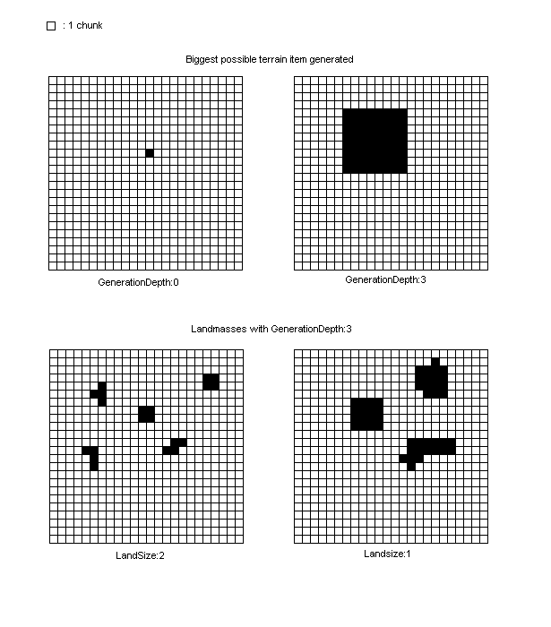
The smallest unit of size that the generator can create is 1 chunk. By default, GenerationDepth has a value which is around 10. Every new increase of 1 for GenerationDepth is a double in size for the largest thing the generator will be able to generate. The biggest possible size for a generated surface will then be 2GenerationDepth.
Important note: the following description is not true for biomes set as Border or Isle, only for normal Biomes. Borders and Isles will be explained right after.
At first, the world is a full Ocean. Once GenerationDepth is determined, the generator will add land areas (not biomes yet, only landmass) on that Ocean. This depends on three parameters: LandSize , LandRarity and LandFuzzy .
LandRarity has “useful” values from 90 to 99 (100 if you want very little or no Ocean). It’s not a linear function, so below 94 it’s very difficult to find any land.
LandSize will determine size of landmasses, and then the generator will add ice areas with IceSize the same way.
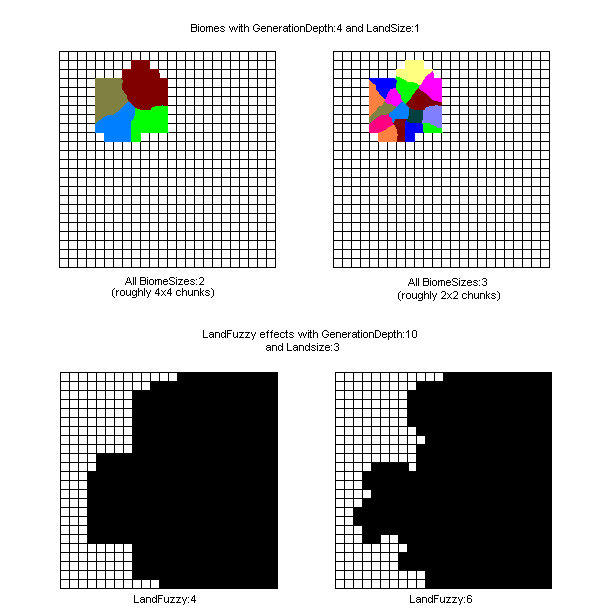
LandFuzzy adds irregularities to the landmass borders (maybe biome borders ?). Its value has to be between 0 and GenerationDepth - LandSize because those irregularities use the accuracy of the generator. with value 0 there won’t be any fuzzy added to the land borders, and maximum LandFuzzy values will add lots of irregularities which size will vary from half of the landsize (LandSize - 1) to 1 chunk.
After that, the generator will fill in the biomes, from the largest (small BiomeSize value) to the tiniest (large BiomeSize value).
I’ve determined that the biggest sized item the generator can create will be roughly 2GenerationDepth times bigger than 1 chunk.
Demonstration: 1. Open a reset world. 2. Go to coordinates 0,0 and look towards east. 3. Go forward until you step on a new biome, then stop. 4. Note your coordinates which are at the limit between biomes (x or z should be 0). 5. Increase GenerationDepth by 1. Reset the world and open it again. 6. Repeat steps 2 to 5 as many times as desired.
These are the results I got :
| GenerationDepth | Distance |
|---|---|
| 9 | 34 |
| 10 | 67 |
| 11 | 136 |
| 12 | 269 |
If you look well you may notice that the distance doubles when increasing GenerationDepth by 1. In every direction it’s the same pattern.
The following table is a direct consequence of that. With a biome taken from the first line, you can find biomes smaller than half a chunk because of other settings. I made it with a special biome with a very high BiomeHeight. It made it easier to spot while researching for GenerationDepth and other size variables.
Note that the same table can be used for BiomeSize and IceSize instead of LandSize .
Because the values in this table are theoretical, the size of biomes, land and iceland will differ from the values indicated here but a biome A with 1 more in BiomeSize than a biome B will always have approximately 4 times the surface of biome B. I have still to determine an acceptable margin of error for this ; until then it should be accepted as a good enough approximation that two biomes with the same size class have a surface ratio inferior to 4, and two biomes with 1 in size class difference should have a surface ratio between 2 and 8.
| LandSize | GD - LandSize | Land size in chunks | Land size in blocks |
|---|---|---|---|
| GD | 0 | 1 | 16x16 = 256 |
| GD-1 | 1 | 4 (not 2 because it’s a surface and 2*2=4) | 32x32 = 1.024 |
| GD-2 | 2 | 16 | 64x64 = 4.096 |
| GD-3 | 3 | 64 | 128x128 = 16.384 |
| GD-4 | 4 | 256 | 256x256 = 65.536 |
| GD-5 | 5 | 1024 | 512x512 = 260.000 |
| GD-6 | 6 | 4096 | 1024x1024 = 1.000.000 |
| ... | ... | ... | ... |
| 1 | GD-1 | 4GD-1 | 2GD-1x2GD-1 |
| 0 | GD | 4GD | 2GDx2GD |
Recap :
- GenerationDepth : Largest possible size for an item.
- GenerationDepth - Landsize : The bigger it is, the bigger the land size.
- GenerationDepth - Icesize : The bigger it is, the bigger the ice size.
- GenerationDepth - BiomeSize : The bigger it is, the bigger the biome size (not true for Isle Biomes).
- A decrease of 1 in size class means a double size in blocks.
The settings explained
Variable names
WorldConfig
BiomeConfigs
PluginConfig
BO2 Objects
BO3 Objects
Land Fuzzy
Other pages
Examples page
Commands and Permissions
Compatibility with other mods
Compatibility with WorldPainter
External tutorials
- General tutorial by mysource
- Effect of the seed on a map and working with higher (y>128) worlds by mysource
- Achieve certain world styles by mysource
- Create a map by image by mysource
- World merging by mysource
- How Terrain Control's biome generator works by Khoorn
- Cave variables explained by thedeadlytao
- GenerationDepth and LandSize/Rarity Explained by thedeadlytao

